- Welcome to Great Lakes Bass Fishing Forum.

Michigan and Great Lakes Bass Fishing Forum

 Shoutbox
Say Hi or something!


djkimmel
2026-02-16, 12:16:52Stop by Booth 5715 at Outdoorama this week starting Thursday, February 19 in Novi! You know where!
djkimmel
2026-01-18, 11:50:18Great to see quite a few of you at the 2026 Ultimate Fishing Show. Now, on to Outdoorama Feb. 19-22.
djkimmel
2026-01-08, 07:22:54Stop by Booth 3054 right next door to Xtreme Bass Tackle and say hello today January 8 through January 11.
djkimmel
2026-01-01, 13:07:42Thanks detroit1
detroit1
2025-12-06, 09:52:48Hi Dan, see you next month.
Advertisement
Recent Topics
-
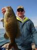 Smallmouth Bass Bully
by Bigbass201
Smallmouth Bass Bully
by Bigbass201
[July 01, 2026, 04:55:13 PM] -
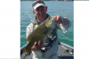
Smallmouth Bass Underwater View on Lake Charlevoix
by Bigbass201
[May 21, 2026, 07:12:06 AM] -
Michigan Commercial Fishing Going After Walleye and Perch, Smallmouth Bass Risk
by djkimmel
[May 09, 2026, 03:53:56 PM] -
 New to rod building
by fiker
New to rod building
by fiker
[April 14, 2026, 04:10:00 AM] -
 Rod Repair, contact me
by bob o
Rod Repair, contact me
by bob o
[April 08, 2026, 05:26:39 PM] -
Tons of Seminars at 81st Ultimate Sport Show Grand Rapids
by djkimmel
[March 01, 2026, 08:15:37 AM]
Latest Articles
Sat, 16 May 2026 19:31:33 +0000
UPDATE 5/31/2026: At least 6 Michigan State Representatives have removed their sponsorship from HB 5801 and 5802. Your actions are having an impact! Thank you! There was discussion at the May 20 House Committee, but the bills remain in committee.
Wed, 06 May 2026 13:21:52 +0000
The poorly written, damaging to Michigan Sport Fishing commercial fishing bills have been introduced again. State House Bills 5801 and 5802, introduced by Rep. Dave Prestin and Rep. Jason Morgan, have been assigned to the House Committee on Natural Resources and Tourism.
Wed, 25 Mar 2026 20:27:21 +0000
This is a tale of two lakes. Intertwined lakes, in Barry County, Michigan. Where somehow the water has gone away. Upper and Lower Crooked Lakes, both near and dear to me, are suffering from the lowest water levels I've seen in the 35+ years I've been fishing them.
Sun, 01 Mar 2026 13:07:47 +0000
81st Ultimate Sport Show - Grand Rapids with over 4 Acres of Fishing and Hunting Gear, Outdoor Travel, Fishing Boats, Seminars, Displays and Features, March 12-15, 2026.
Mon, 16 Feb 2026 17:05:49 +0000
If you enjoy the outdoors – hunting, fishing, boating, camping etc. – then Vibe Credit Union Showplace, Novi is the place for you and your family Feb. 19-22 when the 53rd Annual Outdoorama returns to town.
Advertisement
Angling Technologies Mapping Program
Started by Dan, September 23, 2010, 12:44:04 PM
Previous topic - Next topic0 Members and 1 Guest are viewing this topic.
User actions