
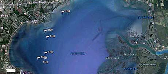
The Michigan Department of Natural Resources, Lake St. Clair Fisheries Research Station will be conducting a fisheries survey in Anchor Bay, Lake St. Clair, from April 25 to May 24, 2012. The primary purpose of the survey is to assess the status of predator fish populations in the lake. The survey gear used will be trap nets, located along a 10-foot contour, between the Clinton River and New Baltimore.
Each of the nets will be marked with at least two floating flags and nine smaller bouys. The nets are approximately 650 feet long. Boaters and anglers are encouraged to watch out for these markers and to avoid boating or fishing near them.
Anglers who catch tagged fish, are encouraged to report the catch to the MDNR. Anglers can call the Lake St. Clair Fisheries Research Station (586-465-4771) to report catching tagged fish or if they have additional questions regarding the net survey. Anglers can also report catching a tagged fish on the internet at http://www.michigandnr.com/taggedfish/.
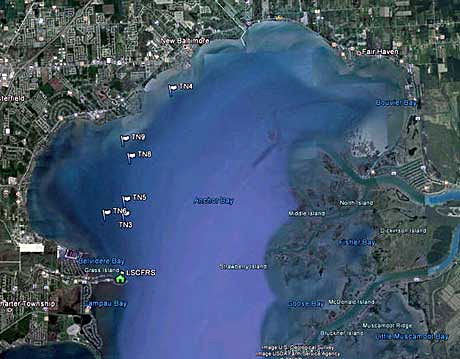
Individual net locations are approximately:
Latdeg Latdmin   Longdeg Longdmin
42 36.964        82 46.730
42 36.931        82 46.149
42 37.263        82 46.118
42 38.235        82 45.936
42 38.627        82 46.120
42 39.747        82 44.622
Thank you. – Mike
Michael Thomas
Fisheries Research Biologist
Lake St. Clair Fisheries Research Station
33135 South River Road
Harrison Township, MI 48045
thomasm4@michigan.gov